Sources
Lebanese Ministry of Interior and Municipalities - www.interior.gov.lb
Central Administration of Statistics - www.cas.gov.lb
Chamate is located in the kaza of Jbeil, an administrative division of the muhafazah of Kesrouane Al Fatouh-Jbeil.
| Muhafazah | Kaza | Distance from Beirut (km) |
|---|---|---|
| Kesrouane Al Fatouh-Jbeil | Jbeil | 47 |
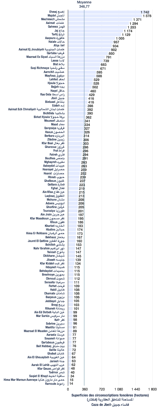
The following data are based from a publication of the Central Administration of Statistics (2005). (non-exhaustive list).
| Registration divisions | Area (hectares) |
|---|---|
| Chamate | 108 |
| Kaza | # of registration divisions | Average (hectares) | Total of areas (hectares) |
|---|---|---|---|
| Jbeil | 100 | 347 | 34,677 |
| Village/towns/cities | # of mukhtar·s |
|---|---|
| Chamate | 1 |
The following data are taken from the primary voters lists, published by the Ministry of Interior and Municipalities in early 2017
| Voters | Grecs-orthodoxes | Maronites |
|---|---|---|
| 463 | 19 | 444 |
| # | Bureau | Circonscription | Quartier | Électeurs | Abstentions | Votants | Blancs & nuls | Exprimés | % participation | % abstention |
|---|---|---|---|---|---|---|---|---|---|---|
| 115 | كنيسة مار مخايل | جبيل | شامات | 432 | 148 | 284 | 3 | 281 | 66 | 34 |