Sources
Lebanese Ministry of Interior and Municipalities - www.interior.gov.lb
Central Administration of Statistics - www.cas.gov.lb
Ouadi Bnehlay is located in the kaza of Chouf, an administrative division of the muhafazah of Mont-Liban.
| Muhafazah | Kaza |
|---|---|
| Mont-Liban | Chouf |
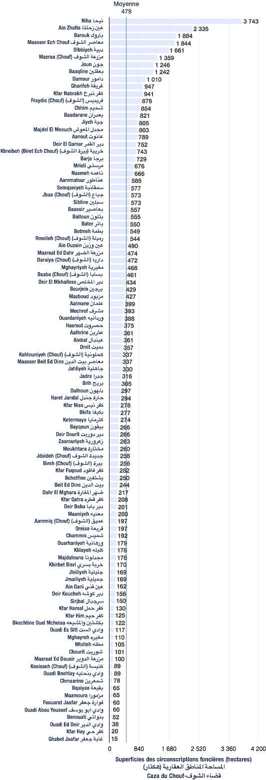
The following data are based from a publication of the Central Administration of Statistics (2005). (non-exhaustive list).
| Registration divisions | Area (hectares) |
|---|---|
| Ouadi Bnehlay | 89 |
| Kaza | # of registration divisions | Average (hectares) | Total of areas (hectares) |
|---|---|---|---|
| Chouf | 100 | 479 | 47,904 |
| Village/towns/cities | # of mukhtar·s |
|---|---|
| Ouadi Bnehlay | 1 |
The following data are taken from the primary voters lists, published by the Ministry of Interior and Municipalities in early 2017
| Voters | Grecs-orthodoxes | Maronites |
|---|---|---|
| 861 | 78 | 783 |
| # | Bureau | Circonscription | Quartier | Électeurs | Abstentions | Votants | Blancs & nuls | Exprimés | % participation | % abstention |
|---|---|---|---|---|---|---|---|---|---|---|
| 278 | الكنيسة غرفة رقم 1 | الشوف | وادي بنحليه | 380 | 149 | 231 | 2 | 229 | 61 | 39 |
| 279 | الكنيسة غرفة رقم 2 | الشوف | وادي بنحليه | 400 | 191 | 209 | 4 | 205 | 52 | 48 |