Sources
Lebanese Ministry of Interior and Municipalities - www.interior.gov.lb
Central Administration of Statistics - www.cas.gov.lb
Btibyat is located in the kaza of Baabda, an administrative division of the muhafazah of Mont-Liban.
| Muhafazah | Kaza | Distance from Beirut (km) |
|---|---|---|
| Mont-Liban | Baabda | 31 |
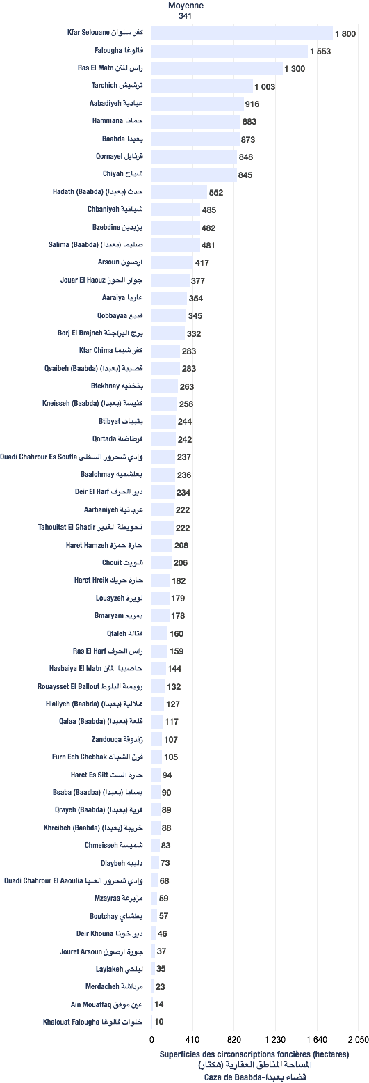
The following data are based from a publication of the Central Administration of Statistics (2005). (non-exhaustive list).
| Registration divisions | Area (hectares) |
|---|---|
| Btibyat | 244 |
| Kaza | # of registration divisions | Average (hectares) | Total of areas (hectares) |
|---|---|---|---|
| Baabda | 57 | 341 | 19,440 |
| Village/towns/cities | # of mukhtar·s |
|---|---|
| Btibyat | 1 |
The following data are taken from the primary voters lists, published by the Ministry of Interior and Municipalities in early 2017
| Voters | Druzes |
|---|---|
| 362 | 362 |
| # | Bureau | Circonscription | Quartier | Électeurs | Abstentions | Votants | Blancs & nuls | Exprimés | % participation | % abstention |
|---|---|---|---|---|---|---|---|---|---|---|
| 238 | الخلية | بعبدا | بتبيات | 333 | 124 | 209 | 4 | 205 | 63 | 37 |