Sources
Lebanese Ministry of Interior and Municipalities - www.interior.gov.lb
Central Administration of Statistics - www.cas.gov.lb
Deir Baba is located in the kaza of Chouf, an administrative division of the muhafazah of Mont-Liban.
| Muhafazah | Kaza | Distance from Beirut (km) |
|---|---|---|
| Mont-Liban | Chouf | 34 |
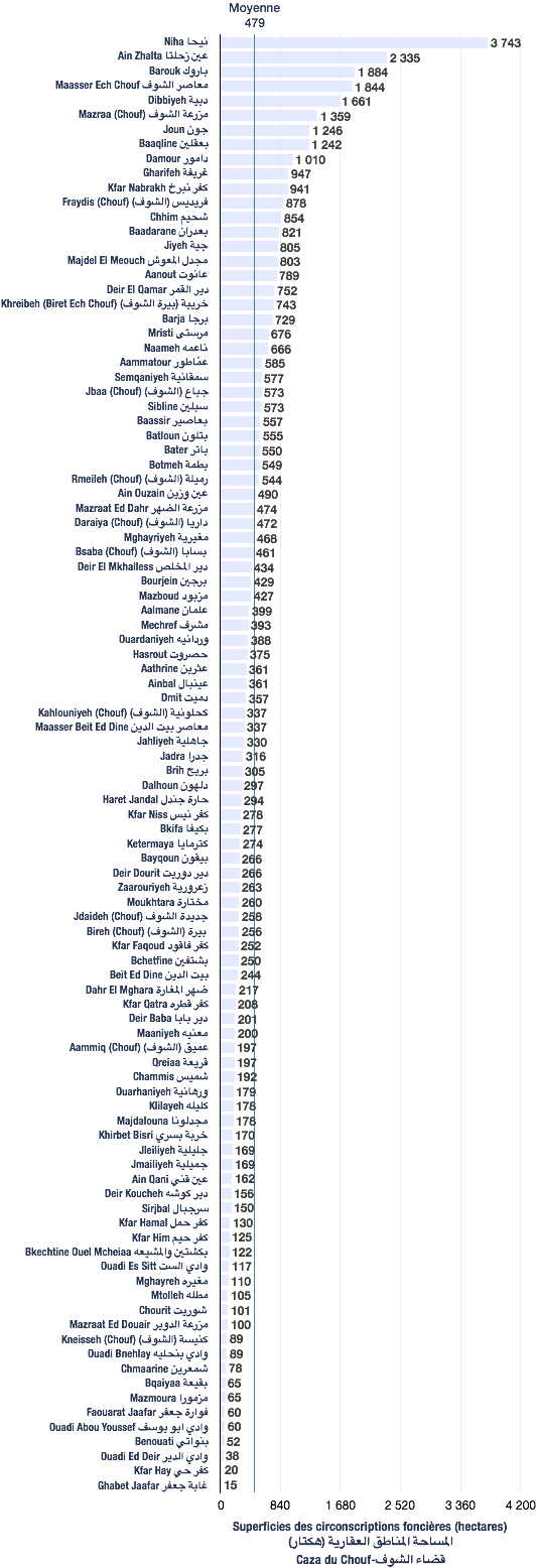
The following data are based from a publication of the Central Administration of Statistics (2005). (non-exhaustive list).
| Registration divisions | Area (hectares) |
|---|---|
| Deir Baba | 201 |
| Kaza | # of registration divisions | Average (hectares) | Total of areas (hectares) |
|---|---|---|---|
| Chouf | 100 | 479 | 47,904 |
| Village/towns/cities | # of mukhtar·s |
|---|---|
| Deir Baba | 1 |
The following data are taken from the primary voters lists, published by the Ministry of Interior and Municipalities in early 2017
| Voters | Druzes |
|---|---|
| 911 | 911 |
| # | Bureau | Circonscription | Quartier | Électeurs | Abstentions | Votants | Blancs & nuls | Exprimés | % participation | % abstention |
|---|---|---|---|---|---|---|---|---|---|---|
| 273 | الجمعية الخيرية – مركز الخدمات الاجتماعية غرفة رقم 1 | الشوف | دير بابا | 408 | 199 | 209 | 3 | 206 | 51 | 49 |
| 274 | الجمعية الخيرية – مركز الخدمات الاجتماعية غرفة رقم 2 | الشوف | دير بابا | 456 | 244 | 212 | 7 | 205 | 46 | 54 |