Ouadi Jilo

Submitted by Michel | 12/07/2017 - 14:39 | Updated: 01/23/2019 - 18:31 | Views: 302
Sources
Lebanese Ministry of Interior and Municipalities - www.interior.gov.lb
Official Journal - Lebanese Republic - www.pcm.gov.lb
Central Administration of Statistics - www.cas.gov.lb
OMSAR - www.dawlati.gov.lb

Location

Ouadi Jilo is located in the kaza of Sour, an administrative division of the muhafazah of Liban-Sud.

Muhafazah Kaza
Liban-Sud Sour

Area of ​​the registration division

The following data are based from a publication of the Central Administration of Statistics (2005). (non-exhaustive list).

Registration divisions Area (hectares)
Ouadi Jilo 433
Kaza # of registration divisions Average (hectares) Total of areas (hectares)
Sour 75 544 40,809

Local authorities

Village/towns/cities # of mukhtar·s
Ouadi Jilo 1

Electorate

The following data are taken from the primary voters lists, published by the Ministry of Interior and Municipalities in early 2017

Composition of the electorate according to primary electoral lists (early 2017)
Voters Chiites
673 673

Élections législatives libanaises de 2009

Données des élections législatives de 2009 par bureaux de vote
# Bureau Circonscription Quartier Électeurs Abstentions Votants Blancs & nuls Exprimés % participation % abstention
230 المدرسة الرسمية صور وادي جيلو 534 153 381 4 377 71 29

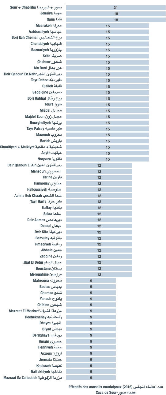
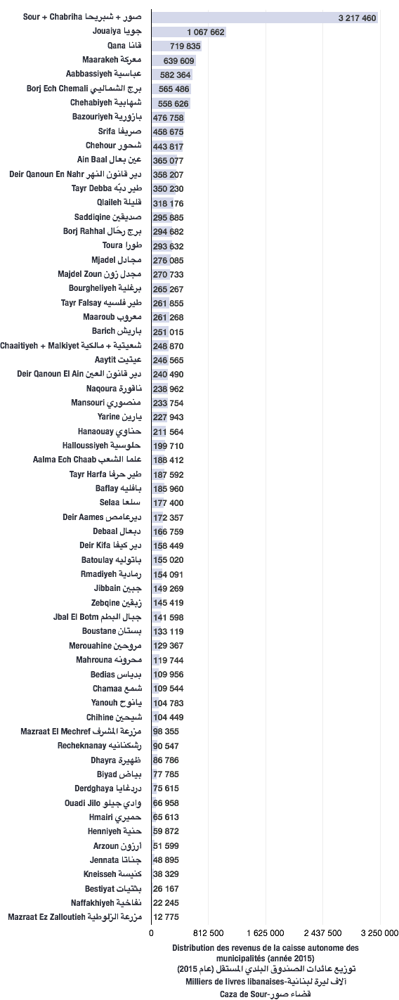
Distribution of the independent municipal fund proceeds

The following data are taken from decrees published in the Official Journal. Amounts are in thousands of Lebanese pounds.

Municipalities’ shares by year in thousands of Lebanese pounds (LBP)
2015
66,958